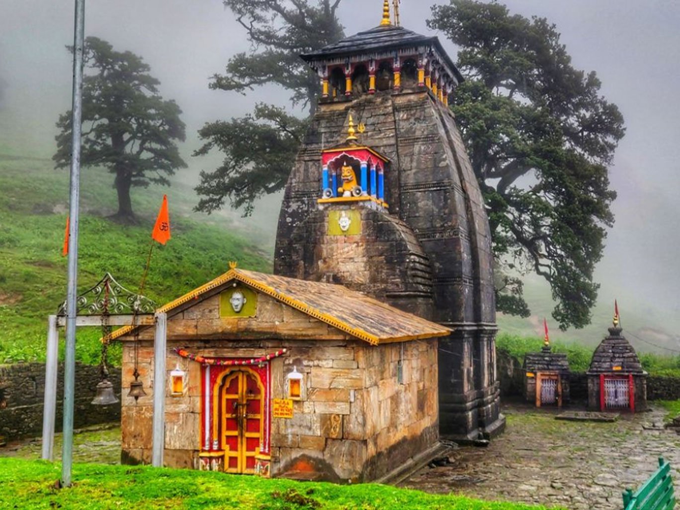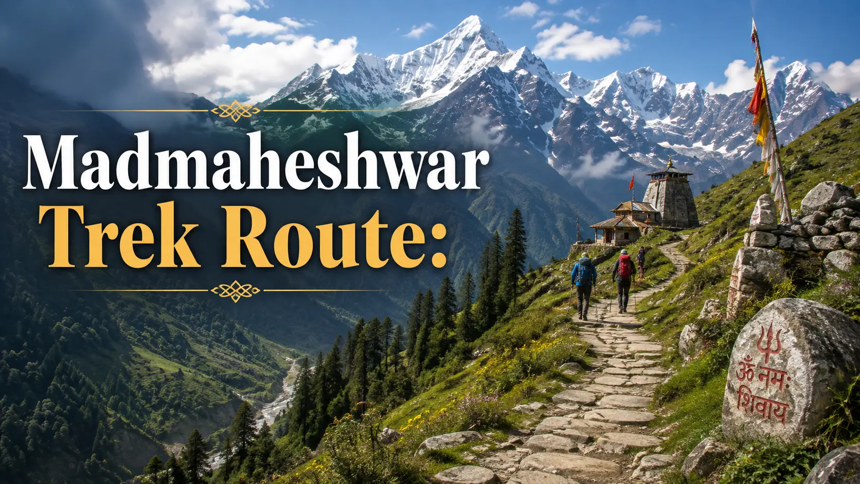
The Madmaheshwar Trek route takes pilgrims and trekkers from Ransi Village through Gaundhar, Bantoli, Khatara, and Nanu before reaching the sacred Madhyamaheshwar Temple in the Garhwal Himalayas of Uttarakhand.
For most travelers today, Ransi serves as the practical starting point of the walking trail. From here, the route leaves road access behind and moves through forested slopes, traditional Himalayan settlements, river valleys, steep stone paths, and increasingly open mountain terrain.
The basic route is easy to understand:
Ukhimath → Ransi → Gaundhar → Bantoli → Khatara → Nanu → Madhyamaheshwar Temple
What is less straightforward is the exact trekking distance.
Different published sources give different measurements because some older route descriptions begin the trek at Uniana, while current travel planning commonly treats Ransi as the road-accessible trailhead. The official Uttarakhand Tourism Panch Kedar Circuit describes a 19 km trek beginning from Uniana, with Ransi reached after approximately 3 km and Gaundhar another 6 km farther.
Modern trekking guides commonly calculate the walking distance from Ransi instead.
For practical planning, it is therefore better to understand the route stages and landmarks rather than depending on a single exact kilometer figure.
Madmaheshwar Trek Route at a Glance
Stage | Route | Mode | What to Expect |
|---|---|---|---|
1 | Ukhimath → Ransi | Road | Final approach to trek base |
2 | Ransi → Gaundhar | Trek | Initial village and forest section |
3 | Gaundhar → Bantoli | Trek | Shorter connection toward river valley |
4 | Bantoli → Khatara | Trek | Sustained uphill section |
5 | Khatara → Nanu | Trek | Forest and upper-trail transition |
6 | Nanu → Madhyamaheshwar | Trek | Final ascent toward temple |
Optional | Madhyamaheshwar → Budha Madhyamaheshwar | Trek | Additional high-altitude extension |
Practical trek start: Ransi Village
Destination: Madhyamaheshwar Temple
Trail access: Walking only beyond Ransi
Route character: Village paths, forests, river sections, stone trails, steep climbs, and upper Himalayan terrain
Where Does the Madmaheshwar Trek Start?
The practical trekking route begins from Ransi Village.
Travelers usually approach Ransi through Ukhimath before leaving the motorable route and continuing toward Madhyamaheshwar on foot.
Ransi is therefore more than simply another village on the journey. It is the point where road travel ends and the mountain trek begins.
Trekkers commonly organize their final supplies, meals, accommodation, cash, and trekking arrangements here before entering the trail.
For detailed information about the trailhead, facilities, food, and village itself, read our Ransi Village Guide.
Why Do Madmaheshwar Trek Distance Figures Vary?
Different route descriptions use different starting points. Older or official tourism references may calculate the trek from Uniana, while most present-day travellers use Ransi as the practical road-accessible base.
For this reason, distance figures online can vary.
If you need detailed one-way, round-trip and Budha Madhyamaheshwar calculations, read our complete Madmaheshwar Trek Distance Guide.
For route planning, focus on the trail sequence:
Ransi → Gaundhar → Bantoli → Khatara → Nanu → Madhyamaheshwar Temple
Plan according to trail stages, daylight, weather, fitness, and confirmed overnight stops.
Stage 1: Ukhimath to Ransi Village
Ukhimath is the main town travelers encounter before proceeding toward Ransi.
This is the best stage of the journey for completing practical preparations because facilities become increasingly limited once you move toward the trekking trail.
Before leaving the Ukhimath area, consider organizing:
Cash
Essential medicines
Trekking snacks
Rain protection
Basic first aid
Power banks
Offline maps
Identification documents
Any necessary local transport
Travelers who want to explore or stay in the town can use our Ukhimath Travel Guide.
From the Ukhimath side, continue by road toward Ransi.
Once you reach Ransi, the walking section of the Madhyamaheshwar journey begins.
Stage 2: Ransi to Gaundhar
The first major trekking section takes travelers from Ransi toward Gaundhar Village.
Official Uttarakhand Tourism places Gaundhar approximately 6 km beyond Ransi on its Panch Kedar route description.
The trail moves away from the road-connected settlement and into the quieter Himalayan valley.
This section introduces trekkers to the landscape that defines much of the lower Madhyamaheshwar route:
Forested slopes
Stone and mountain paths
Small streams
Traditional settlements
Agricultural patches
River-valley scenery
The initial portion of a trek can sometimes feel easier because the body is still fresh.
Avoid using that feeling as a reason to walk too quickly.
Maintain a sustainable pace from the beginning.
Gaundhar is an important settlement along the trail and can function as a rest or overnight point depending on the itinerary.
For village-specific information, see our Gaundar Village Guide.
Stage 3: Gaundhar to Bantoli
After Gaundhar, the trail continues toward Bantoli.
This is an important geographic transition on the route.
Bantoli is associated with the river-confluence section of the Madhyamaheshwar trail and is a useful place to understand what lies ahead.
The journey up to this point should not give trekkers a false impression that the remaining route will be equally manageable.
Beyond the Bantoli area, the character of the trek changes.
The sustained uphill effort becomes considerably more noticeable.
Trekkers should use this section to:
Refill water where appropriate
Eat something light
Check the weather
Adjust backpack straps
Rest briefly
Assess group fitness
Confirm there is sufficient daylight ahead
Avoid taking an excessively long break if the weather is unstable or you still have substantial climbing ahead.
Stage 4: Bantoli to Khatara
The route beyond Bantoli is one of the sections where trekkers begin to feel the true physical nature of the Madhyamaheshwar climb.
The path rises steadily through mountain terrain and forest.
Accumulated fatigue becomes increasingly important here.
Someone who started too quickly from Ransi may struggle much more on this section than a trekker who maintained a controlled pace from the beginning.
Khatara Village serves as a useful route landmark and resting point during this upper climb.
Do not expect extensive commercial infrastructure.
Khatara is a small mountain settlement rather than a developed tourist stop.
The purpose of identifying it on your route map is mainly to understand your progress between Bantoli and the higher trail.
For detailed information about the settlement, facilities, food expectations, and trail conditions, read our Khatara Village Guide.
Stage 5: Khatara to Nanu
From Khatara, the route continues toward Nanu and the higher sections of the Madhyamaheshwar trail.
As elevation increases, the environment gradually changes.
Dense lower forest begins giving way to more open sections, depending on the exact stretch and season.
The trail remains physically demanding because trekkers have already accumulated several hours of walking before reaching this stage.
This is not the time to race another group.
Maintain your own pace.
Take short breaks where appropriate.
Continue drinking water regularly.
Watch for changing cloud cover and temperature.
Mountain weather can change quickly, especially later in the day.
Stage 6: Nanu to Madhyamaheshwar Temple
The final stage leads toward the Madhyamaheshwar temple area.
As the trail approaches the upper valley, the landscape becomes increasingly open and the atmosphere changes noticeably from the forested lower sections.
This final approach can be one of the most rewarding portions of the journey.
However, seeing the upper landscape should not encourage tired trekkers to suddenly increase their pace.
Fatigue-related slips often happen when travelers feel the destination is close and stop concentrating on their footing.
Continue steadily until you reach the temple area safely.
The arrival at Madhyamaheshwar marks the end of the main Ransi-to-temple trekking route.
Madmaheshwar Trek Route Map
The complete practical route can be visualized as:
Rishikesh / Haridwar
↓
Rudraprayag
↓
Ukhimath
↓
Ransi Village — Trek Starts
↓
Gaundhar Village
↓
Bantoli
↓
Khatara Village
↓
Nanu
↓
Upper Trail
↓
Madhyamaheshwar Temple
This sequence is more useful for practical navigation than trying to memorize one total distance.
A detailed external route breakdown is also available in TourMyHoliday's How to Reach Madhyamaheshwar Temple: Route and Travel Options.
Which Section of the Madmaheshwar Trek Is Hardest?
For most trekkers, the route becomes substantially more demanding after the lower Gaundhar–Bantoli section.
The sustained uphill climb beyond Bantoli requires considerably more effort than the earlier approach.
Difficulty also depends on:
Personal fitness
Backpack weight
Weather
Sleep
Hydration
Trekking experience
Daily distance
Walking pace
A person with good fitness who walks steadily may find the route manageable.
Someone who starts too fast, carries unnecessary weight, or has not trained for uphill walking can struggle much earlier.
If physical preparation is your main concern, follow our 30-Day Madhyamaheshwar Trek Fitness Plan.
Can You Complete Ransi to Madhyamaheshwar in One Day?
Some strong and experienced trekkers may complete long sections of the route in one day.
That does not mean every traveler should attempt the same schedule.
Trying to cover too much distance can create problems when:
You start late
Weather deteriorates
Someone becomes exhausted
Trail conditions are wet
You carry a heavy backpack
Daylight runs out
Accommodation plans change
A slower itinerary often allows a better experience and reduces unnecessary pressure.
Do not choose your daily trekking target simply because someone online completed the route faster.
Where Should You Stay Along the Route?
Accommodation exists at selected points on or around the Madhyamaheshwar trail, but the quality and availability are very different from conventional tourist destinations.
Expect simple Himalayan accommodation rather than luxury hotels.
Possible staging areas can include:
Ukhimath
Ransi
Gaundhar
Bantoli or nearby trail facilities
Madhyamaheshwar temple area
Availability can change with season and pilgrimage traffic.
Rather than duplicating stay information on this route page, use our dedicated Madhyamaheshwar Trek Accommodation Guide.
Madmaheshwar Trek Route During Monsoon
Monsoon conditions can completely change how long individual trail stages take.
Wet stone becomes slippery.
Streams can rise.
Visibility can fall rapidly.
Road access to Ransi can also experience weather-related disruption before the trek even begins.
A route that feels manageable in dry conditions can become much more demanding during persistent rain.
Anyone planning a July or peak-monsoon journey should read our Madhyamaheshwar Trek in July Guide instead of relying only on normal-season route timings.
Navigation and Mobile Network on the Route
Do not assume that continuous mobile connectivity will be available throughout the trek.
Before leaving the road-connected section:
Save important phone numbers offline.
Download offline maps if required.
Screenshot accommodation details.
Inform family members about limited connectivity.
Charge your phone fully.
Carry a power bank.
Keep identification protected from rain.
The physical trail and current local instructions should take priority over blindly following an online map.
Mountain paths can change because of rain, maintenance, landslides, or temporary diversions.
What to Carry on the Route
Keep your backpack practical.
Useful items include:
Trekking shoes with reliable grip
Drinking water
Energy snacks
Warm layer
Rain jacket or poncho
Trekking pole if useful
Sunscreen
Sunglasses
Cap
Personal medicines
Basic first-aid supplies
Power bank
Headlamp
Cash
Offline information
Waste bag
Avoid packing unnecessary items.
The longer the climb continues, the more every extra kilogram matters.
Common Route Planning Mistakes
A simple route can still become difficult when planning is poor.
Common mistakes include:
Starting Too Late
An early departure provides more daylight and flexibility if conditions change.
Walking Too Fast from Ransi
The lower trail may feel manageable, but the harder climbing comes later.
Relying on Exact Online Distances
Different sources measure the trail differently. Use route landmarks and current local guidance.
Depending on Mobile Internet
Connectivity may be unreliable.
Carrying Too Much
Heavy backpacks increase fatigue substantially during sustained uphill sections.
Ignoring Weather
Mountain conditions can change faster than expected.
Planning Without a Backup Halt
Always know what you will do if your intended stage takes longer than expected.
For more planning errors and solutions, read Common Madhyamaheshwar Trek Mistakes.
Optional Extension to Budha Madhyamaheshwar
Reaching Madhyamaheshwar Temple completes the main trekking route from Ransi.
Travelers with suitable fitness, weather, and time may choose to continue to the higher Budha Madhyamaheshwar area.
This is an additional trek, not part of the main Ransi-to-Madhyamaheshwar distance.
Do not automatically add the extension after arriving exhausted at the temple.
Rest, assess the weather, and decide whether the additional climb is suitable.
Our dedicated Budha Madhyamaheshwar Temple Guide covers that section separately.
Madmaheshwar Trek Route FAQs
What is the Madmaheshwar Trek route?
The practical route follows Ransi → Gaundhar → Bantoli → Khatara → Nanu → Madhyamaheshwar Temple. Travelers normally reach Ransi by road through the Ukhimath side before beginning the trek.
Where does the Madmaheshwar Trek start?
For most current travel planning, Ransi Village serves as the practical trekking trailhead.
How long is the Madmaheshwar Trek?
Modern trekking resources commonly describe approximately 16–18 km of walking from Ransi, while Uttarakhand Tourism's Panch Kedar circuit documents a 19 km trek beginning from Uniana and places Ransi after the first 3 km. The difference reflects varying starting points and trail measurements.
What comes after Ransi?
Gaundhar is the first major village stop after Ransi on the Madhyamaheshwar trekking route.
What comes after Gaundhar?
The trail continues toward Bantoli before beginning the more demanding upper climb.
Is Khatara on the Madmaheshwar Trek route?
Yes. Khatara is a small trail settlement encountered on the upper section between Bantoli and the higher route toward Madhyamaheshwar.
What is the hardest part of the route?
For many trekkers, the sustained uphill section after Bantoli is more demanding than the earlier Ransi-to-Gaundhar portion.
Can beginners complete the route?
Fit beginners can consider the trek, but adequate walking endurance, sensible pacing, appropriate equipment, and realistic daily stages are important.
Is the Madmaheshwar Trek route motorable?
No. Road access reaches the trailhead area, but the main route from Ransi toward Madhyamaheshwar is completed on foot.
Is Budha Madhyamaheshwar included in the main route?
No. Budha Madhyamaheshwar is an additional uphill extension after reaching the main Madhyamaheshwar Temple.
Final Thoughts
The Madmaheshwar Trek route is easier to plan when you stop thinking of it as one long distance and instead understand it as a sequence of distinct Himalayan stages.
The practical route is:
Ransi → Gaundhar → Bantoli → Khatara → Nanu → Madhyamaheshwar
Ransi marks the transition from road travel to trekking. Gaundhar provides the first important village landmark. Bantoli marks a major transition before the harder climbing begins. Khatara and Nanu help trekkers understand their progress through the upper trail. Madhyamaheshwar Temple is the destination. Published distance figures may differ, but the route sequence remains far more useful for real-world planning. Start early, maintain a steady pace, carry essential supplies, confirm local trail conditions, and allow enough flexibility for weather or fatigue. A well-planned route does not simply help you reach Madhyamaheshwar faster. It helps you reach it safely and with enough energy left to appreciate why you made the journey in the first place.